Skip to catalogue

June 21 — September 20

Boston outdoors

Concierge

What are you in the mood for today?

Live search needs the app server. Browsing this city’s day below.

Checking concierge availability…

Your day in Boston

23 ideas for Saturday, July 25, 2026

44 fixed time0 places with confirmed hours19 with published schedule80 with flexible access0 with unknown time

143 Boston activities · updated July 24, 2026 at 2:20 p.m.

10:00 AM · confirmed time
EventRegular Event

Dune and Bog Walk

<p>1-2 hours, 1-2 miles in loose sand. Head out from the Province Lands Visitor Center to explore an<br />enchanting landscape of sand dunes and wild cranberry bogs. </p> <p><span class="NormalTextRun SCXW187906810 BCX8">Meet at the Province Lands Visitor Center, with </span><span class="NormalTextRun SCXW187906810 BCX8">a </span><span class="NormalTextRun SCXW187906810 BCX8">possible caravan</span><span class="NormalTextRun SCXW187906810 BCX8"> to a nearby site</span><span class="NormalTextRun SCXW187906810 BCX8">. </span><span class="NormalTextRun SCXW187906810 BCX8"> </span></p>

⌖ Cape Cod National Seashore · Province Lands Visitor Center, 171 Race Point Road, Provincetown, MA · Boston
Practical information
Published schedule
1-2 hours.
Cost
Free

Sources checked Jul 24, 2026
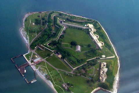
Art in the Park on Georges Island
11:30 AM · confirmed time
EventRegular Event

Art in the Park on Georges Island

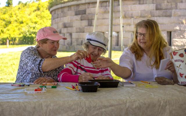
<p>Unleash your creativity with a variety of art activities designed to enrich your island experience. Test your hand at watercolors, write and illustrate nature haikus, learn to decode signal flags, and explore sun printing.</p> <p>NOTE: <a href="https://www.bostonharborislands.org/ferry-tickets/" target="_blank" rel="nofollow noopener noreferrer">Ferry tickets</a> must be purchased to attend this event. Georges Island is accessible via public ferry. To purchase ferry tickets, please visit the Ferry Information page on the <a id="menur33i" class="fui-Link ___1q1shib f2hkw1w f3rmtva f1ewtqcl fyind8e f1k6fduh f1w7gpdv fk6fouc fjoy568 figsok6 f1s184ao f1mk8lai fnbmjn9 f1o700av f13mvf36 f1cmlufx f9n3di6 f1ids18y f1tx3yz7 f1deo86v f1eh06m1 f1iescvh fhgqx19 f1olyrje f1p93eir f1nev41a f1h8hb77 f1lqvz6u f10aw75t fsle3fq f17ae5zn" title="https://www.bostonharborislands.org/ferryschedule/" href="https://www.bostonharborislands.org/ferryschedule/" target="_blank" rel="noopener noreferrer" data-bs-toggle="modal" data-bs-target="#myModal" data-toggle="modal" data-target="#myModal" data-remote="/common/commonspot/customcf/modals/modal_intercept.cfm?targetURL=https%3A%2F%2Fwww.bostonharborislands.org%2Fferryschedule%2F">Boston Harbor Islands partnership website</a>.</p> <p>Events may be effected by weather. Please ask the Boston Harbor Welcome Center for updates.</p> <p> </p>

⌖ Boston Harbor Islands National Recreation Area · Georges Island · Boston
Practical information
Published schedule
11:30 am to 3 pm
Cost
Free

Sources checked Jul 24, 2026

Boston Harbor Now

Free Outdoor Tango @ Kendall Urban Park Roof Garden
5:30 PM · confirmed time
EventCommunity Event

Free Outdoor Tango @ Kendall Urban Park Roof Garden

Running from Jul 17, 2026 to Sep 18, 2026

Free Outdoor Tango @ Kendall Urban Park Roof Garden! PopUp Summer Free tango on the KENDALL URBAN PARK ROOF GARDEN on Fridays from 5:30–8:30pm! We host a free class for beginners, too, so all are welcome!

⌖ Kendall Urban Park (UP) Roof Garden · 325 Main Street · Cambridge
Practical information
Published schedule
2026-07-24 17:30–20:30
Cost
Free

Sources checked Jul 24, 2026

MIT Events Calendar

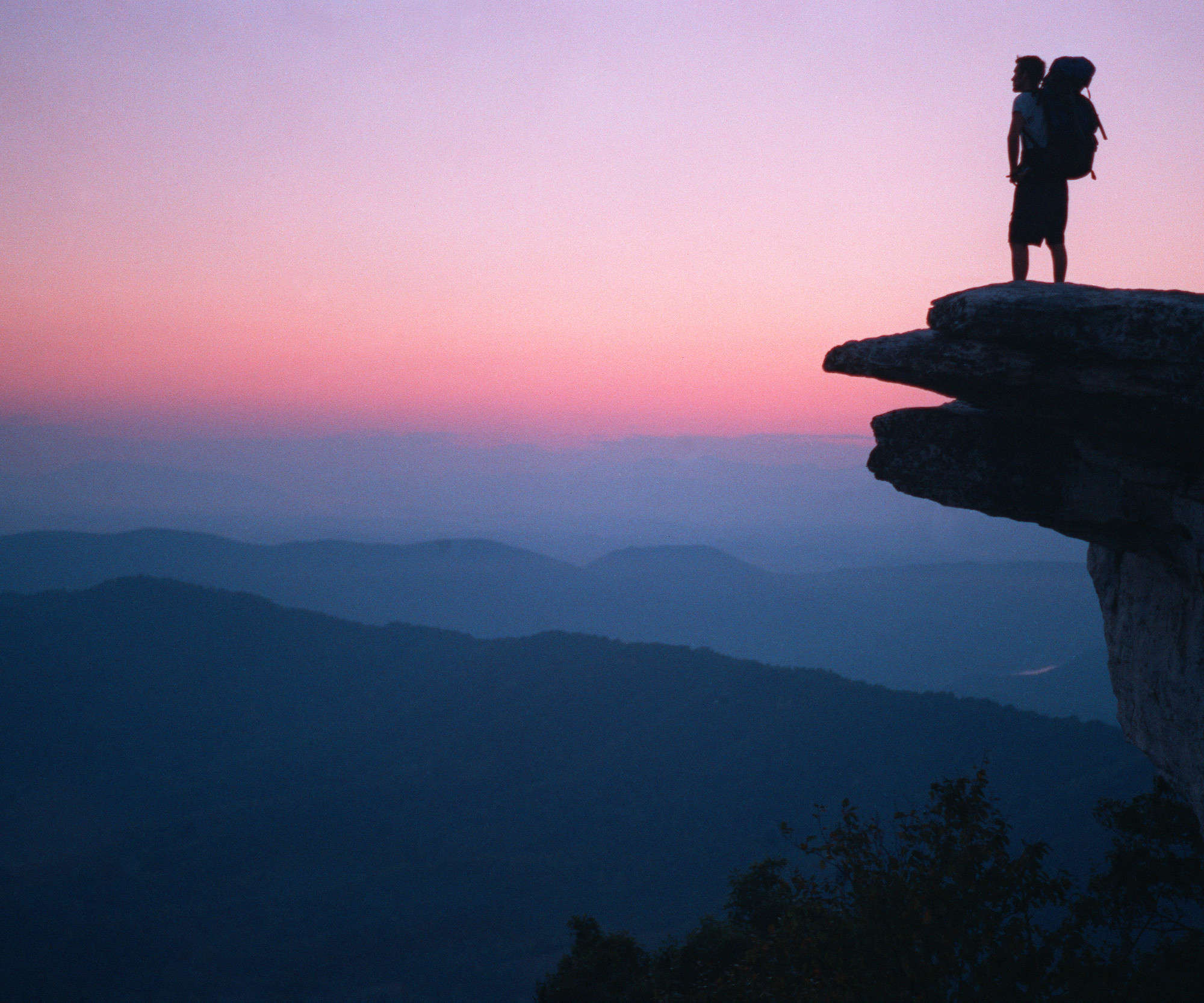
Silhouette of a man with backpack standing on McAfee Knob at sunset with mountains in the distance.
Published schedule
PlaceParks & Nature

Appalachian National Scenic Trail

The Appalachian Trail is a 2,190+ mile long public footpath that traverses the scenic, wooded, pastoral, wild, and culturally resonant lands of the Appalachian Mountains. Conceived in 1921, built by private citizens, and completed in 1937, today the trail is managed by the National Park Service, US Forest Service, Appalachian Trail Conservancy, numerous state agencies and thousands of volunteers.

⌖ Appalachian National Scenic Trail · Appalachian Trail Park Office · Harpers Ferry
Practical information
Published schedule
In general, the Appalachian Trail is open year-round. The northern terminus at Mount Katahdin in Maine is within Baxter State Park, which may be closed in winter months, depending on weather conditions. Particular sections of the Trail, and less-developed roads accessing the Trail, may be closed temporarily for a number of reasons, but otherwise the trail is open.
Cost
Free entry

Sources checked Jul 24, 2026

Photo Credit: ATC/Benjamin Hays

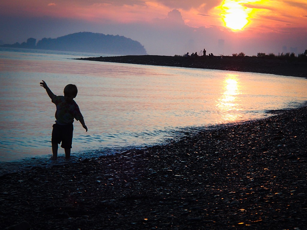
A child dancing on the beach at dusk
Published schedule
PlaceParks & Nature

Boston Harbor Islands National Recreation Area

. . . where you can walk a Civil War-era fort, view historic lighthouses, explore tide pools, hike lush trails, camp under the stars, or relax while fishing, picnicking, or swimming—all within reach of downtown Boston. Youth programs, visitor services, research, wildlife management, and more are coordinated on the park's 34 islands and peninsulas by the Boston Harbor Islands Partnership.

⌖ Boston Harbor Islands National Recreation Area · Boston Harbor Islands National and State Park · Charlestown
Practical information
Published schedule
Boston Harbor Islands is a Partnership park. Operating hours and seasons vary. Visit bostonharborislands.org to plan your trip.
Cost
Free entry

Sources checked Jul 24, 2026

NPS Photo

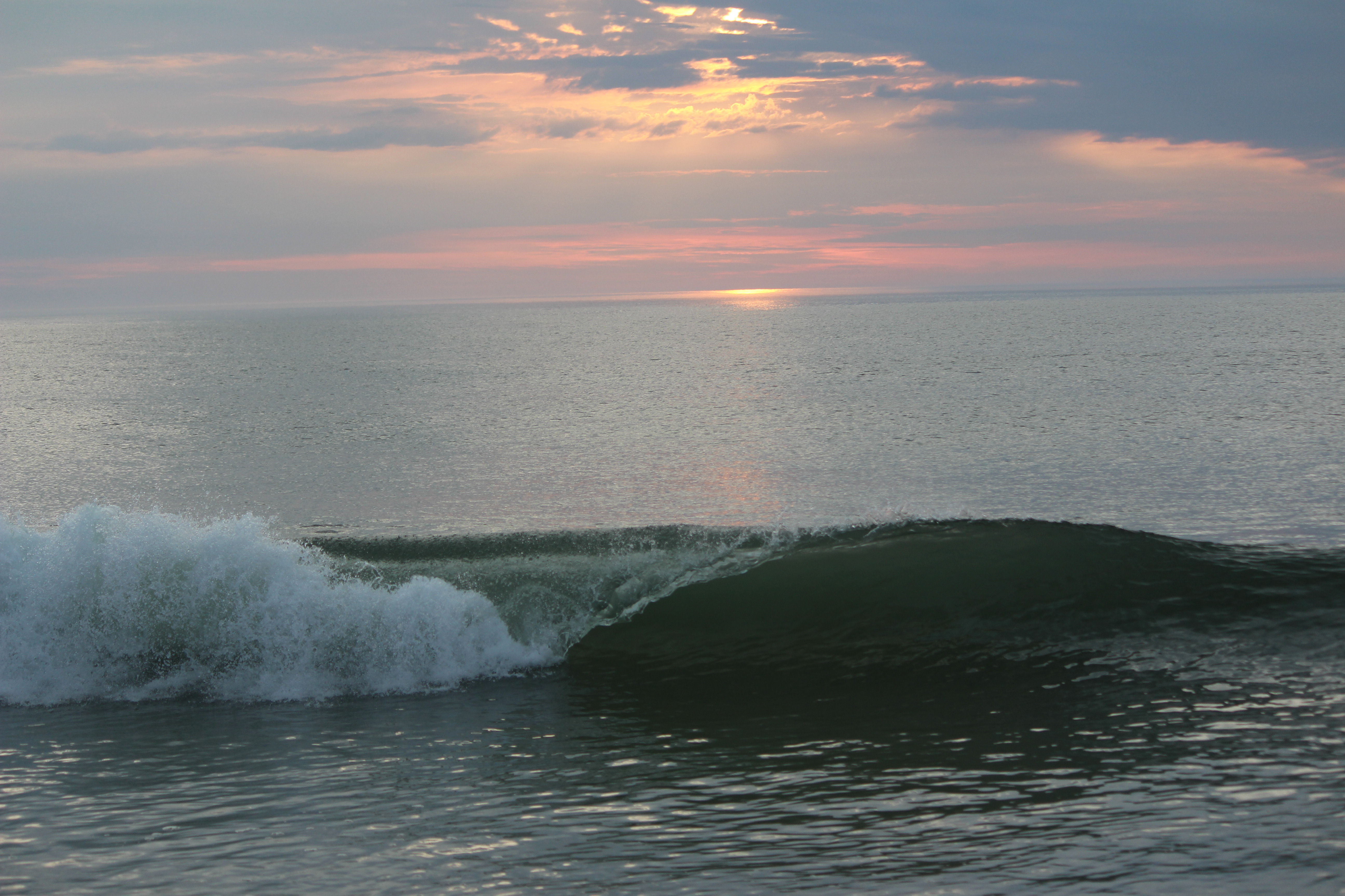
A curling wave breaks against the backdrop of a pink sunrise.
Published schedule
PlaceParks & Nature

Cape Cod National Seashore

The great Outer Beach described by Thoreau in the 1800s is protected within the national seashore. Forty miles of pristine sandy beach, marshes, ponds, and uplands support diverse species. Lighthouses, cultural landscapes, and wild cranberry bogs offer a glimpse of Cape Cod's past and continuing ways of life. Swimming beaches and walking and biking trails beckon today's visitors.

⌖ Cape Cod National Seashore · 50 Nauset Road · Eastham
Practical information
Published schedule
Beaches, parking areas, and trails are open year-round between 6 am and midnight.
Cost
Entrance - Private Vehicle: $25

Sources checked Jul 24, 2026

NPS image

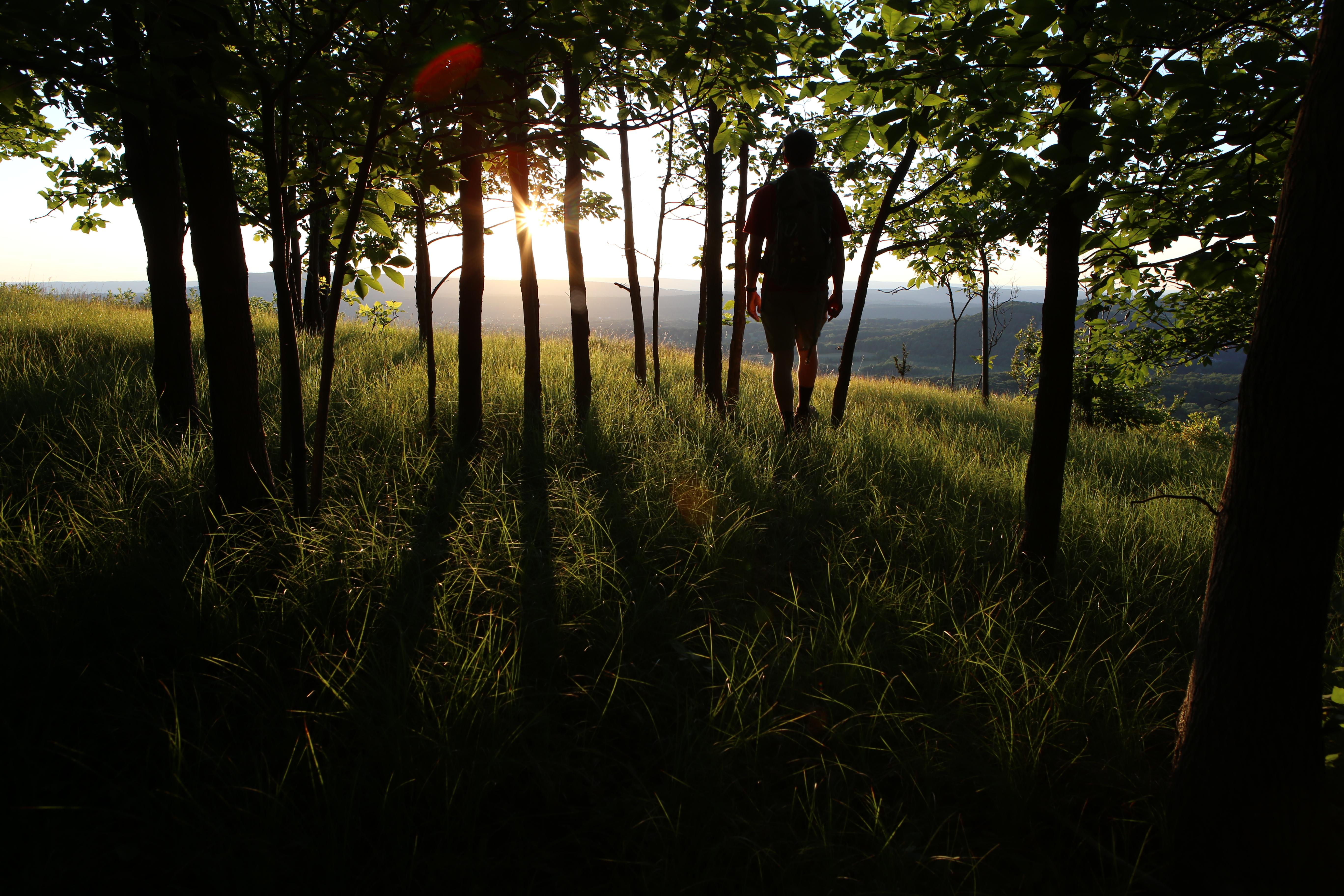
Hiker in trees at overlook with sunset in background
Published schedule
PlaceParks & Nature

New England National Scenic Trail

From the Sound to the summits: the New England Trail covers 235 miles from Long Island Sound across long ridges to scenic mountain summits in Connecticut and Massachusetts. The trail offers panoramic vistas and close-ups of New England’s natural and cultural landscape: traprock ridges, historic village centers, farmlands, unfragmented forests, quiet streams, steep river valleys and waterfalls.

⌖ New England National Scenic Trail · New England Trail · Springfield
Practical information
Published schedule
As the New England trail crosses private property and state land, many locations along the trail do not permit night hiking or overnight parking. Before going out on a hike, check the hours of local parks for parking and hiking regulations.
Cost
Free entry

Sources checked Jul 24, 2026

AMC Photo

Arnold Arboretum
Flexible access
PlaceParks and open space

Arnold Arboretum

The Arnold Arboretum is a botanical research institution and free public park affiliated with Harvard University and located in the Jamaica Plain and Roslindale neighborhoods of Boston. Established in 1872, it is the oldest public arboretum in North America.

⌖ Arnold Arboretum · Boston

Image: Wikimedia Commons

Back Bay Fens
Flexible access
PlaceParks and open space

Back Bay Fens

The Back Bay Fens, often simply referred to as "the Fens," is a parkland and urban wild in Boston, Massachusetts, United States. It was established in 1879. Designed by Frederick Law Olmsted to serve as a link in the Emerald Necklace park system, the Fens gives its name to the Fenway-Kenmore neighborhood.

⌖ Back Bay Fens · Boston
Practical information
Cost
From Wikipedia, the free encyclopedia; Daily Free Press

Sources checked Jul 16, 2026

Image: Wikimedia Commons

Boston Common
Flexible access
PlaceParks and open space

Boston Common

The Boston Common is a public park in downtown Boston, Massachusetts. It is the oldest city park in the United States. Boston Common covers 50 acres (20 ha) of land bounded by five major Boston streets: Tremont Street, Park Street, Beacon Street, Charles Street, and Boylston Street.

⌖ Boston Common · Boston
Practical information
Cost
Boston Common continues to be a stage for free speech and public assembly. Here, during the 20th century, Charles Lindbergh promoted commercial aviation. Anti-Vietnam War and civil right rallies were held, including one led by Martin Luther King, Jr. In 1979, Pope John Paul II celebrated Mass.
Parking
Pay parking ticket; Resident parking stickers; How do I pay a parking ticket?; How do I get a resident parking sticker?

Sources checked Jul 16, 2026

Image: Wikimedia Commons

Boston Harbor Islands National and State Park
Flexible access
PlaceParks and open space

Boston Harbor Islands National and State Park

Boston Harbor Islands National and State Park is a combination national recreation area and state park situated among the islands of Boston Harbor, Massachusetts, United States. The park is made up of 34 islands and peninsulas and is managed by the Boston Harbor Islands Partnership.

⌖ Boston Harbor Islands National and State Park · Boston
Practical information
Cost
Free & Discounted Access; Take advantage of free fitness classes throughout the summer.

Sources checked Jul 16, 2026

Image: Wikimedia Commons

Boston Harborwalk
Flexible access
PlaceParks and open space

Boston Harborwalk

Boston Harborwalk is a public walkway that follows the edge of piers, wharves, beaches, and shoreline around Boston Harbor. When fully completed it will extend a distance of 47 miles (76 km) from East Boston to the Neponset River.

⌖ Boston Harborwalk · Boston
Practical information
Cost
Free and Discounted Access; Sign up for what interests YOU most: news, free fun, volunteer opportunities, or all of the above!

Sources checked Jul 16, 2026

Image: Wikimedia Commons

Boston Public Garden
Flexible access
PlaceParks and open space

Boston Public Garden

The Public Garden, also known as Boston Public Garden, is a large park in the heart of Boston, Massachusetts, adjacent to Boston Common.

⌖ Boston Public Garden · Boston
Practical information
Parking
Pay parking ticket; Resident parking stickers; How do I get a resident parking sticker?

Sources checked Jul 16, 2026

Image: Wikimedia Commons

Castle Island (Massachusetts)
Flexible access
PlaceParks and open space

Castle Island (Massachusetts)

Castle Island is a peninsula in South Boston on the shore of Boston Harbor. The landmass was an island until 1928, when it was connected to the mainland by a narrow strip of land. Castle Island has been the site of a fortification since 1634, and is currently a recreation site and the location of Fort Independence.

⌖ Castle Island (Massachusetts) · Boston
Practical information
Cost
From Wikipedia, the free encyclopedia; "All men free and brethren: Prince Hall and black Freemasonry"; "Fort Independence's Free Tour Season Has Begun"

Sources checked Jul 16, 2026

Image: Wikimedia Commons

Charles River Esplanade
Flexible access
PlaceParks and open space

Charles River Esplanade

The Charles River Esplanade is a park in the Back Bay neighborhood of Boston, Massachusetts, United States. Owned by the Commonwealth of Massachusetts, it is located on the south bank of the Charles River Basin and comprises part of the Charles River Reservation. The park was dedicated in 1910 as the Boston Embankment.

⌖ Charles River Esplanade · Boston
Practical information
Cost
GroundBeat: The Esplanade’s Free Riverfront Music Series

Sources checked Jul 16, 2026

Image: Wikimedia Commons

Emerald Necklace
Flexible access
PlaceParks and open space

Emerald Necklace

The Emerald Necklace consists of a 1,100-acre (4.5 km2; 450 ha) chain of parks linked by parkways and waterways in Boston and Brookline, Massachusetts. It was designed by landscape architect Frederick Law Olmsted, and gets its name from the way the planned chain appears to hang from the "neck" of the Boston peninsula.

⌖ Emerald Necklace · Boston

Image: Wikimedia Commons

Franklin Park (Boston)
Flexible access
PlaceParks and open space

Franklin Park (Boston)

Franklin Park, a partially wooded 527-acre (2.13 km2) parkland bordered by the Jamaica Plain, Roxbury, and Dorchester neighborhoods of Boston, Massachusetts, is maintained by the City of Boston Parks and Recreation Department. It is Boston's biggest park and the site of the Franklin Park Zoo.

⌖ Franklin Park (Boston) · Boston
Practical information
Cost
From Wikipedia, the free encyclopedia

Sources checked Jul 16, 2026

Image: Wikimedia Commons

Georges Island (Massachusetts)
Flexible access
PlaceParks and open space

Georges Island (Massachusetts)

Georges Island is one of the islands in the Boston Harbor, situated just over 7 miles (11 km) from downtown Boston. The island has a permanent size of 39 acres (160,000 m2), plus an intertidal zone of a further 14 acres (57,000 m2), and rises to a height of 50 feet (15 m) above sea level. Historic Fort Warren is on the island.

⌖ Georges Island (Massachusetts) · Boston
Practical information
Cost
From Wikipedia, the free encyclopedia

Sources checked Jul 16, 2026

Image: Wikimedia Commons

Jamaica Pond
Flexible access
PlaceParks and open space

Jamaica Pond

Jamaica Pond is a kettle lake, part of the Emerald Necklace of parks in Boston designed by Frederick Law Olmsted. The pond and park are in the Jamaica Plain neighborhood of Boston, close to the border of Brookline.

⌖ Jamaica Pond · Boston
Practical information
Cost
From Wikipedia, the free encyclopedia

Sources checked Jul 16, 2026

Image: Wikimedia Commons

Mount Auburn Cemetery
Flexible access
PlaceParks and open space

Mount Auburn Cemetery

Mount Auburn Cemetery, located in Cambridge and Watertown, Massachusetts, is the first rural or garden cemetery in the United States. It is the burial site of many prominent Boston Brahmins, and is a National Historic Landmark.

⌖ Mount Auburn Cemetery · Cambridge
Practical information
Parking
Directions & Parking

Sources checked Jul 16, 2026

Image: Wikimedia Commons

Rose Fitzgerald Kennedy Greenway
Flexible access
PlaceParks and open space

Rose Fitzgerald Kennedy Greenway

The Rose Kennedy Greenway is a linear park located in several Downtown Boston neighborhoods. It consists of landscaped gardens, promenades, plazas, fountains, art, and specialty lighting systems that stretch over one mile through Chinatown, the Financial District, the Waterfront, and North End neighborhoods.

⌖ Rose Fitzgerald Kennedy Greenway · Boston
Practical information
Cost
Free events, Public Art, gardens, fountains, and more - all in the heart of Boston; Your charitable gift will support access to free community-led public programming and art, beautiful landscapes and fountains, and the thoughtful, comprehensive care and maintenance of The Greenway.

Sources checked Jul 16, 2026

Image: Wikimedia Commons